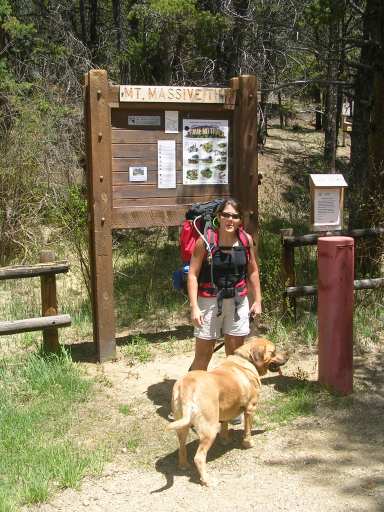
 Our brave hikers at the beginning of the trail.
Colorado Trail -Segment 10
June 3/4, 2006
Distance: 13.2 miles
Elevation Gain: 1760 feet
The Ham Radio Tale
View Log - Another great outing with the KX1. I take along my KX1 with built in tuner, paddle and 6 cell internal power supply, plus a 25' wire , a 16' counterpoise and an 8 cell external power pack. The external power pack allows me to save the expensive lithium cells of the internal supply for emergency use if the external supply goes down. This night we were camped by a river in a valley but I threw my wire in the closest tree and made several qso's, including a short qso with a Japanese ham who was on a cruise in the South Pacific Ocean!
The Hiking Tale
We hoped to be out of the house at 7AM and on the trail by 10:30. Instead we were out of the house at 8:30 and on the trail at 12:30. Yep, there was a couple wrong turns in there someplace. We were going to hike the trail backwards, from south to north. We set the pickup at the end of our trail which was actually about 2 miles into segment 9 because this is more convienient parking. For the same reason, this is where we had stopped on segment 9 so we had to get that little chunk of the trail done anyway. For some reason Segment 10 starts at a spot where the CT crosses a road and there is no parking there! So... the easiest method is to consider the parking area about 1.8 miles into segment 9 as the start and park your car there. We then took the 30minute drive to the beginning of the trail and set the other car at the Mount Massive trailhead, the beginning of our segment 10.
Saturday was beautiful day. After getting onto the trail at about 12:30, we had hiked the first 7 of the 14 miles by about 4:30. We came to a beautiful river with a bunch of camping spots and decided we should stop. Kind if unusual for us on a 2 day hike because we usually try to do about 2/3 of the hike the first day, leaving a shorter hike for the next day when we're bound to be sore and less enthusiastic. Anyway... the camp was great. We boiled a bag of liptons rice and beans plus a bag of bean soup (discovering that at 10,500 ft elevation you needed to boil the rice and beans twice as long as the package says... amazing it took us so long to learn) and had a decent night's sleep.
The next day we started the hike with an immediate uphill climb that took us up to around 11,000 feet and then began descending down the north side of the mountain. New discovery... at 11,000 feet in early June the north side of the mountain still has plenty of snow. The routine set is as: hike 100 feet, cross a 10 foot snow drift, hike 100 feet, cross a 20 foot snow drift, hike 100 feet, cross a 30 foot snow drift, etc, etc. At one of these drifts Terry, leading the way, fell off the drift with her foot between 2 boulders and sprained a knee. After that, she was having a bad time walking but, we had a short distance to go so we weren't too worried. With Terry still hobbled and me trying to carry both backpacks, we ran into a waterfall crossing the path. Normally not too big a deal but with Terry having trouble walking it was a challenge getting across the falls. We did, of course, make the crossing and within a short distance Terry had got her feet under her and, though moving slowly, was carrying her pack again. Before making the bottom of the mountain we crossed another section of the trail which was covered for several hundred feet with a snow drift. We lost the trail under the drift and for quite a while wandered a marshy area looking to pick up the trail. While not terribly worrisome because we were confident in the direction we need to go, we were a little excited because Terry was still having difficulty walking (with her pack) and we didn't want to have to make our own trail through the trees and brush down the mountain. We did find the trail again and soon were down to the base of the mountain and at the end of segment 10. At this point, Terry had to decide to quit or continue. We needed to hike another 2 miles to finish the last piece of segment 9 which we hadn't done before. Terry, with her bad ankle, could let me hike the trail and come back and pick her up at the road, or she could hike on. She hiked on... and we finished up at about 3:30PM.
Our brave hikers at the beginning of the trail.
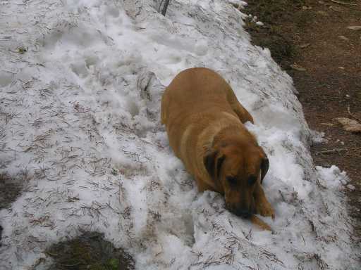 Ellie found the first Snow bank!
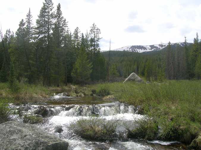
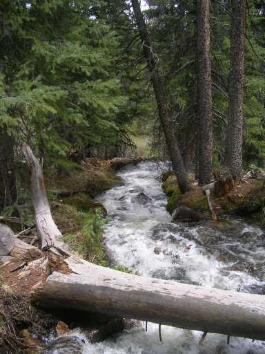 This
is the first river crossing we made.
This
is the first river crossing we made.
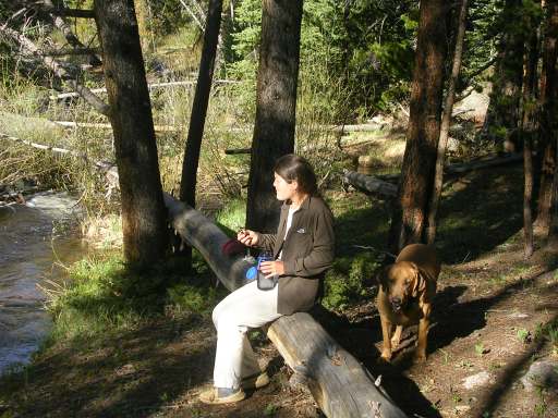
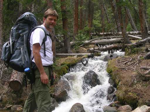 Gary
At River
Gary
At River
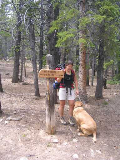 The first 3 miles of this segment of the trail is also the
Mt Massive trail. This is where they split.
The first 3 miles of this segment of the trail is also the
Mt Massive trail. This is where they split.
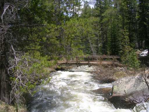
 River
we camped by
River
we camped by
 Terry Brushing her teeth
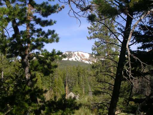 View
of Mount Massive foot hill from our camp
View
of Mount Massive foot hill from our camp
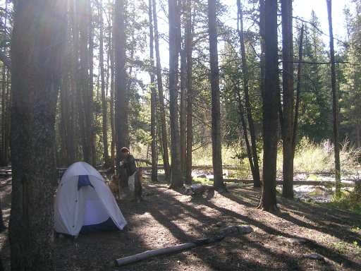 Camp in Morning just as sun coming out
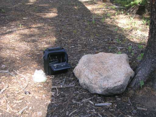 Daylight
operating position
Daylight
operating position
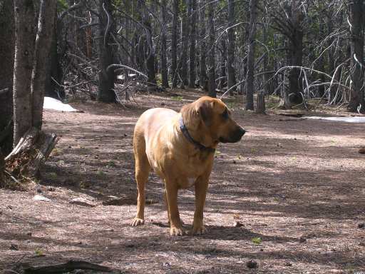 Ellie
on a break
Ellie
on a break
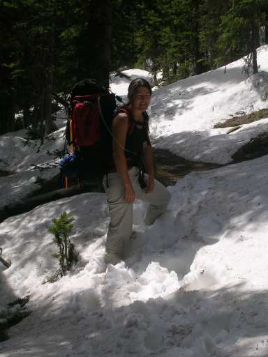 Terry
busting the snow drifts on day 2 just before twisting her knee.
Terry
busting the snow drifts on day 2 just before twisting her knee.
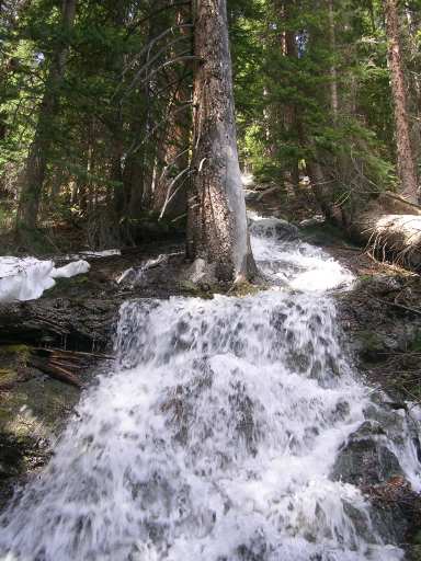 This was the waterfall runnning across the trail. We
hit it just after Terry twisted her knee.
This was the waterfall runnning across the trail. We
hit it just after Terry twisted her knee.
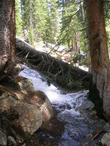 Getting ready to cross the waterfall that crossed the trail!
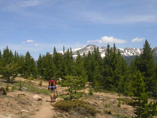 Terry got back on the trail with her sprained knee
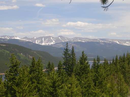 View of Turquoise Lake toward the end of the trail
 One
of many VERY full rivers
One
of many VERY full rivers