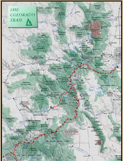
The Colorado Trail is a continuous trail stretching approximately 460 miles from Denver to Durango. The Colorado Trail Foundation has divided the trail into 28 segments and documented each of these segments in an excellent trail guide, 'The Colorado Trail, The Official Guidebook'. The foundation has an excellent website with lots of information about the trail at: www.coloradotrail.org
Terry and I hiked our first Colorado Trail Segment on March 30 & 31, 2002. This web page tracks our progress as we try to hike all 28 segments of the trail. We will be doing this in many separate trips consisting of day hikes, single night backpacks and multiple night backpacks.
| Segment | Location | Distance miles | Elevation Gain in feet | Highest Point in Feet | Date Completed |
| 1 | Waterton Canyon to South Platte River | 15.4 | 2160 | 7200 | |
| 2 | South Platte River to Colorado Trailhead (FS-550) | 11.4 | 2200 | 7840 | 6/1/02 |
| 3 | Colorado Trailhead (FS-550) to FS-543 | 12.1 | 1520 | 8280 | 3//20/02 |
| 4 | Forest Service Road 543 to Long Gulch | 16.2 | 2840 | 10880 | 5/27/02 |
| 5 | Long Gulch to Kenosha Pass | 14.0 | 1540 | 10520 | 5/26/03 |
| 6A | Kenosha Pass to Jefferson Lake Trailhead | 6.0 | 700 | 12000? | 9/07/03 |
| 6B | Jefferson Lake Trailhead to Gold Hill Trailhead | 26.0 | 4520 | 11800 | 7/10/03 |
| 7 | Gold Hill Trailhead to Copper Mountain | 13.1 | 3600 | 12440 | 8/31/03 |
| 8 | Copper Mountain to Tennessee Pass | 24.1 | 4020 | 12280 | |
| 9 | Tennessee Pass to Hagerman Pass Road | 14.9 | 2120 | 11480 | 7/19/02 |
| 10 | Hagerman Pass Road to Halfmoon Creek | 11.4 | 1760 | 11240 | 6/3/06 |
| 11 | Halfmoon Creek to Clear Creek Road | 19.9 | 1520 | 10560 | 9/5/04 |
| 12 | Clear Creek Road to N. Cottonwood Creek Road | 18.2 | 4520 | 11800 | |
| 13a | N. Cottonwood Creek to Avalanch Trailhead | 6.6 | 1000 | 11900 | |
| 13b | Avalanche Trailhead to Chalk Creek Road | 15.6 | 2720 | 9900 | 7/22/06 |
| 14 | Chalk Creek Road to U.S. Highway 50 | 20.0 | 3320 | 9880 | 7/22/06 |
| 15 | U.S. Highway 50 to Marshall Pass | 14.0 | 3440 | 11920 | |
| 16 | Marshall Pass to Sargents Mesa | 14.5 | 3080 | 11600 | |
| 17 | Sargents Mesa to Colorado Highway | 20.3 | 2440 | 11680 | |
| 18 | Colorado Highway 114 to Saguache Park Road | 12.9 | 1220 | 10240 | |
| 19 | Saguache Park Road to Eddiesville Trailhead | 13.5 | 1660 | 10400 | |
| 20 | Eddiesville Trailhead to San Luis Pass | 12.2 | 2960 | 12600 | |
| 21 | San Luis Pass to Spring Creek Pass | 14.5 | 2940 | 12760 | |
| 22 | Spring Creek Pass to Carson Saddle | 16.2 | 3680 | 13240 | |
| 23 | Carson Saddle to Rio Grande Reservoir Road | 12.0 | 1040 | 12920 | |
| 24 | Rio Grande Reservoir Road to Molas Pass | 21.1 | 4460 | 12680 | |
| 25 | Molas Pass to Bolam Pass Road | 19.9 | 3120 | 12490 | |
| 26 | Bolam Pass Road to Hotel Draw Road | 11.0 | 1480 | 11970 | |
| 27 | Hotel Draw Road to Cumberland Basin | 20.1 | 3640 | 12258 | |
| 28 | Cumberland Basin to Junction Creek Trailhead | 21.4 | 1400 | 11600 |